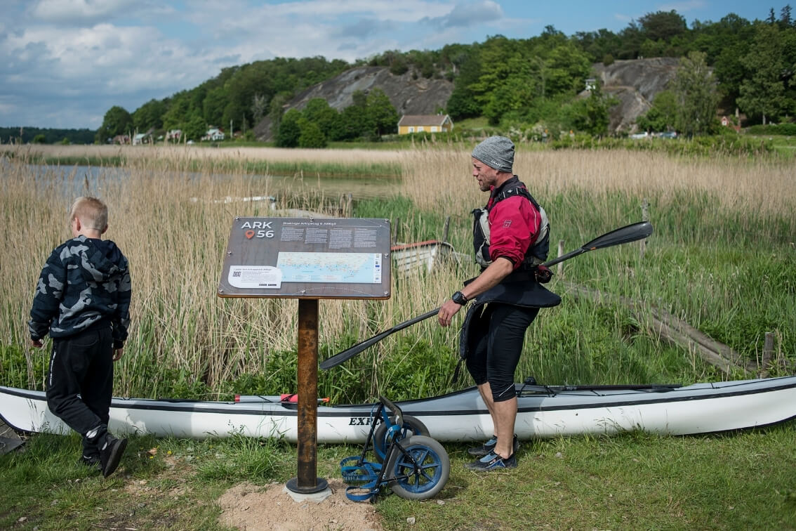
ARK56 sammalänkade outdoorleder i Blekinge.
Havskajakpaddla och gå iland på en lummig skärgårdsö i Blekinge.
ARK56 sammalänkade outdoorleder i Blekinge.

ARK56

ARK56 is a network of trails in the Blekinge Archipelago Biosphere Reserve, designated by UNESCO for its unique natural and cultural values. You will be led through the Blekinge archipelago, along the water. 16 hubs connect the trails and offer food, accommodation, and experiences. At a service hub, you can rent a canoe, kayak, or bicycle, for example, if you want to change modes of transport. Follow ARK56 on Facebook to stay updated.

Paddla kanot längs ARK56 nätverk av leder
Järnavik is one of the hubs in the ARK56 network of trails. Here you can rent a kayak at Paddelkompaniet


Plan your adventure & navigate by using the

ARK56 app

Navigate along the various routes using the ARK56 app on your cellphone. The app easily guides you from windbreak to hotel suite, from open-fire dinner to gourmet restaurant tasting menu, from flair to wilderness. With the planning tool Naturkartan ARK56 (only available in Swedish at this point), you can plan your trip at home in peace. If you prefer a physical map over a digital one, it is easily downloaded on the ARK56 website and available at the tourist offices in Blekinge.

This is an example of what you will find when using Naturkartan. To get the full picture, you need to download the app.


Cykeltur i Blekinge, med ett stopp vid Pensionat Järnavik.
Go cycling through wonderful surroundings and enjoy a good night’s sleep at Pensionat Järnavik


Coastal trails

If you are a hiker, just lace up your boots, prepare your backpack and start trudging along the hiking trail. If you want to take the bike, the paths take you along winding roads through the archipelago landscape. You will find detours and sites to discover in the app. In a kayak, you can go between skerries, around islands and headlands. You glide through a world heritage site and a unique archipelago where the forest goes all the way down to the beach. The app provides suggestions for routes, rounds, and rest areas. For accommodation, restaurants, and all sorts of experiences. If you are not that keen on planning yourself, there are ready-made packages with food and accommodation, kayaking, and much more that allow you to simply move your body, relax and enjoy.

Kustled för cykling, vandring, paddling och segling i Karlskrona
Almöleden is a gorgeous coastal trail overlooking Karlskrona’s archipelago. 


Vill du utforska Blekinges vackra natur?

Följ de välmarkerade lederna med orangea skyltar och stolpar för en problemfri vandring! Utmed dessa sträckor finns allt du behöver – från vatten och toaletter till spännande besöksmål och mysiga övernattningsställen.

Ge dig ut på äventyr - Unika erbjudanden


Ta med din fyrbenta vän på äventyr i Blekinges vackra natur!

Våra vandringsleder är hundvänliga, och du hittar vatten tillgängligt vid starten, mitten och målet av de flesta etapper. Glöm inte att packa extra mat och vatten till din hund för en glad och nöjd upptäcktsfärd tillsammans!


Upptäck Blekinges skönhet på ett mer hands-on sätt med en fysisk ARK56-karta!

Besök Blekinges Turistinformationer för att hämta din egen karta och utforska regionens naturliga underverk. Fråga våra kunniga experter för skräddarsydda tips och råd. Upplev Blekinge på ett nytt sätt med ARK56-kartan i handen!


ARK56, Öppet året om

Upptäck våra unika paketerbjudanden och lämna planerandet bakom dig! ARK56-aktörerna har skapat färdiga paket som inkluderar allt från delikat mat och bekvämt boende till spännande kajakpaddling och mycket mer, allt för att du ska kunna koppla av och njuta fullt ut.

Selected filters:

About the app

When you've downloaded the app, you can use your mobile device to navigate along the trails. The app guides you from shelter to suite, from barbecue area to gourmet restaurant, and from luxury to wilderness. The app is also perfect if you want to plan your trip at home in peace and quiet. If you prefer a physical map, it's easy to download it from the ARK56 website or pick it up at one of the tourist offices.

Get a feel for how the app works

Below you can see a glimpse of how the app works. Feel free to try it out! Click on the icons and filter according to your preferences. But if you want access to the full app, then you need to download it.


Experience adventure along the coast of Blekinge: Discover perhaps Sweden's longest kayaking route spanning 240 km!

Blekinge is known for its beautiful archipelago, but there is also an opportunity to paddle along the entire coast. With a kayak or canoe, you can explore the coastal areas in a unique way and get up close and personal with nature.

Paddling along the coast is a challenging but rewarding experience. From Valje to Torhamn, a distance of over 240 kilometers, the terrain varies from open sea to sheltered bays and fjords.

Along the way, you can stop at small fishing villages, beautiful beaches, and historical sites. There is also an opportunity to explore the many islands along the coast, where you can discover untouched beaches and forests, and perhaps even spot seals and sea eagles. Find the kayaking routes here:

Om ARK56

Biosfärområdet Blekinge Arkipelag drivs och förvaltas av den ideella föreningen med samma namn. Läs mer här - ARK56