- in Sweden's Southernmost Wilderness
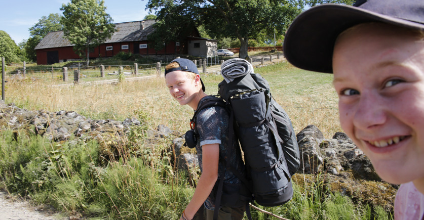
Go explore one of the many hiking trails in Olofström. Experience the silence and the fantastic feeling of being in the middle of nature, close to the wildlife. Settle down, and prepare your meal over an open fire before spending the night under the stars. Enjoy the solitude, or find strength in each other's company. The trails carry on, through the deep forests, past the beautiful lakes, and the small villages towards interesting destinations, rich in culture and history.
Welcome to discover Olofström on foot!
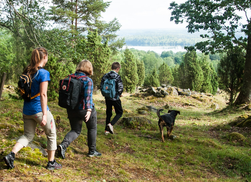
Around Halen, there are several different hiking trails to choose from. Some are short, some a little longer, and the level of difficulty varies to suit as many people as possible. All the trails/options are well marked out and there is a digital map to download – great for planning your trip.
6 popular hikes
Halenrundan 5,7 km (the green trail)
It’s easy to understand why this is the hiker's favorite. The trail offers lake views, challenging slopes and magical views. On at least three locations along the trail, you will find benches and tables, and at two of them, there are also barbecue facilities. Hiking here, you will walk passed one of Blekinge's social media celebrities – the so often tagged and photographed bridge, Frickabron. This is a pram-friendly and accessible trail that most people prefer, and find the most beautiful when walked counter-clockwise. There are parking spaces at Halen's campsite and at Olsanäset's car park. Parts of the trail go through residential areas.
Olsarundan 6,7 km (the purple trail)
This is a trail with mixed terrain through both coniferous and deciduous forest. It passes cultural monuments, lookouts and spots suitable for a dip in the lake. The best choice for parking is Olsanäset's car park, alternatively the car park close to hotel Fritzatorpet. This trail is great for those seeking a challenge. While some sections are pram-friendly and offer easy terrain, there are also sections with tough terrain – don’t forget to hydrate! If you start from the Olsanäset car park, you will find Ropekulle about halfway through the distance. A spot with benches perfectly placed to get you a majestic lookout over Lake Halen. There are two other spots with benches – one of them, Myllevik also presents a barbecue-area, a windbreak and a toilet.
Rödhultsrundan 11,6 km (the pink trail)
A coffee break is mandatory along the way of this trail, the longest one in the area. This trail provides several different starting points/parking options. If you choose to park at Halen's campsite, you get to Bergatorpet's rest area half way through the hike. Bergatorpet is beautifully located next to Lake Halen if you are in the mood for a dip? At Bergatorpet's rest area you will find tables, benches, barbecue facilities, wind protection and a toilet. And there are two more rest areas along this trail. The better part of Rödhultsrundan has an easy terrain, but, since it is quite long, bringing water, a lunch pack or coffee is a good idea. We are certain that you will enjoy a break in Sweden's Southernmost Wilderness
Vargarundan 5,5 km (the blue trail)
Vargarundan (the wolfs trail!) is the only trail in the area that does not pass by a lake. Nevertheless, it’s just as amazing as the others. The trail offers lovely nature experiences in lush, deciduous forests, hilly terrain and through open meadows. Feel free to make a short stop at the wolf pit that can be found along the round. There you will find a short text telling the wolf pit’s story. You would like to park at “P Rödhult”, along Halenvägen. As for the level of difficulty for the trail, it is classified as easy terrain. Close to the path, near the red riding trail, there is a rest area with barbecue facilities.
Around Blåsegylet 1 km (Tillgänglighetsled)
An accessibility adapted shorter trail in the Halen nature reserve, right in the middle of Sweden's Southernmost Wilderness. Here there are tables, benches, barbecue facilities and a toilet. There is also a new jetty (2021), built to improve the access to the water and helping you try your luck at fishing. Actually, fishing is free of charge in Blåsegylet, as long as you stick to angling. Parking is directly adjacent to the trail, along Halenvägen.
Elljusspåret 2,3 km/strong>
Are you up for hiking or trail running after dark? Of course, there is an opportunity to do this in the nice electric light trail, starting at Halen's campsite. A simpler outdoor gym is located next to the loop, for those who want to add more training sessions to the workout.
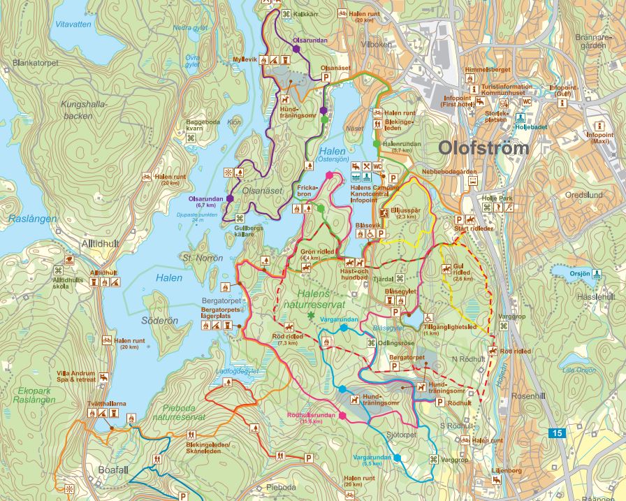
Download the map Halens Friluftsområde or pick it up at the Tourist Office or one of the municipality's info points. You can also buy the outdoor map, Friluftskartan, showing the Halen and Pieboda nature reserves. It is available for digital download here, but you can also buy a weatherproof, printed version for SEK 20.
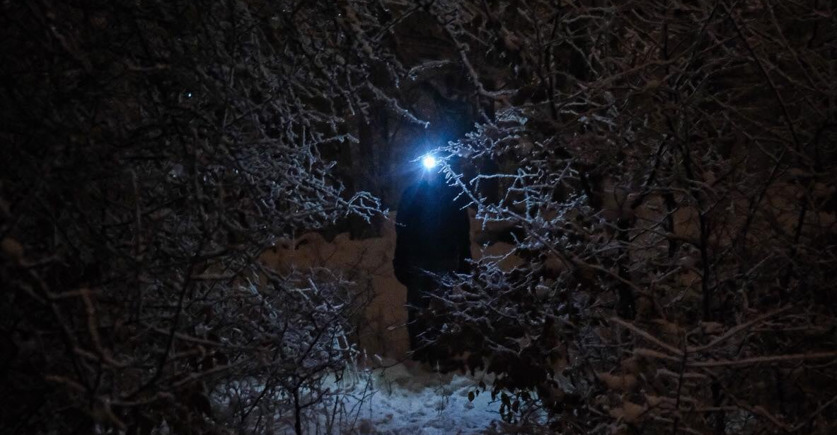
Hike in the dark! Are you curious about spending time outside when darkness has settled over Sweden's Southernmost Wilderness? Several of the trail options in the Halen nature reserve are marked with reflective material. Just charge up the headlamp and head out. It's fantastic to experience the area in the dark, having to rely a bit more on other senses than you usually do.
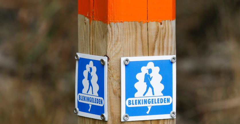
The Blekinge trail
The Blekinge trail can take you all the way to the coast. If you choose to go in the other direction, further towards the lakes in the forest, the Blekinge trail becomes the Skåne trail. The trail is properly marked out, and many beautiful views and overnight accommodation options are offered along the way. There are places designated for barbecues and shelters from the wind if you want to settle down for a while. Read more about the trail and the different subtrails : Hike the Blekinge trail
Three of the subtrails run through Olofström municipality; Boafall–Fritzatorpet 13 km, Fritzatorpet–Slagesnäs 11 km, and Slagesnäs–Angölsmåla 22 km.
STAGE 3: ÖSTAFORS - HALENS CAMPING
Trail facts:15,5 kilometer, 4–6 hours of hiking.
Accommodation: Tent or cottage at the camp site Halens camping. Windbreak at Myllevik, 2,9 km from Halens camping on the eastern side of the lake.
The trail: From the foot of Sibbarpsdalen in Östafors, the Blekinge trail runs parallel to the Skåneleden trail all the way to Olofström in the heart of Sweden's southernmost wilderness. There are plenty of windbreaks to choose from along the beach of lake Halen, however they are also used by the "kayak and canoe people" in the lake system. The subtrail’s services include accommodation, a water tap, a restaurant and toilets.
STAGE 4: HALENS CAMPING - TULSEBODA BRUNNSPARK
Trail facts: 20,5 kilometer, 6-8 hours of hiking
Accommodation: Tent or windbreak at lake Slagesnässjön, just before Kyrkhult. There is also a windbreak at lake Bredasjön about 3 km east of Kyrkhult.
The trail: The Blekinge trail between Olofström and Kyrkhult stretches straight through Olofström municipality, from the scenic waters in the south to Slagesnässjön in the north and the Brunnspark (well park) in Kyrkhult next to Södersjön. Make sure you make time to take a walk in Kyrkhult to experience the magnificent wooden villas from the water-cure era. At the end of the subtrail you will find water and a toilet.
STAGE 5: TULSEBODA BRUNNSPARK–MÖRRUMSÅN
Trail facts: 17,5 kilometer, 5-6 hours of hiking.
Accommodation: Put up your tent at a suitable spot by Mörrumsån river, at the height of Åkeholm. Windbreak in the nature reserve Mörrumsåns Dalgång. Hallandsboda Bed & Breakfast or rented guest house (Eva Stanleysson in Knaggelid, available on Airbnb).
The trail:You leave the beautiful park surrounding the villas in Kyrkhult and walk east through the forest that has great visibility and plenty of mushrooms (depending on the season of course). Along the rapids of the Mörrum River, the trail continues south, through the lovely nature reserve Käringahejan, all the way down to the windbreak in Knaggelid. At the subtrail’s finish there is a windbreak and a toilet. If you need water, scoop it out of Mörrumsån, boil or purify it before drinking.
Expert hiking tips
There is a good, descriptive book about the Blekinge trail (published 2019). It is written by Blekinge’s trail expert/local adventurer Niklas Kämpargård. It will give you all the information you need for your next hike in Blekinge. Buy it at Olofström’s tourist office.