Blekingeleden - Blekinge trail
- Karlshamn
- www.blekingeleden.com
- www.calazo.se/produkt-kategori/kartor
- blekingetrafiken.se/reseinformation/oppen-nartrafik/#vem-kan-anvanda-oppen-nartrafik
-
<% getFormattedDate(occasion) %> <% setPopoverDateLabel(occasion) %>
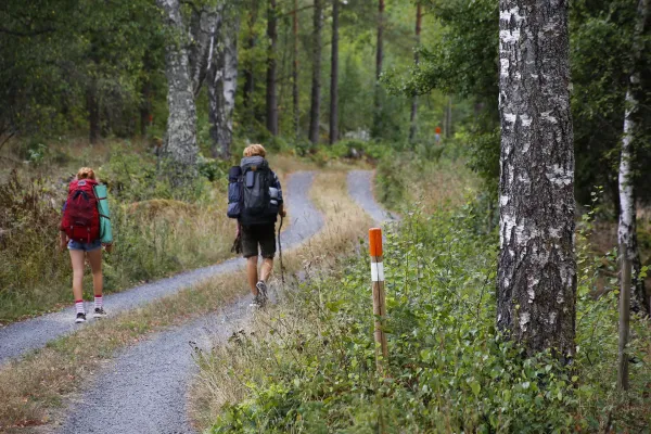
Hiking trail in Blekinge.
Beskrivning
"Blekingeleden" is a trail for hiking that leads through Blekinge, from Sölvesborg in the west to Bröms in the east. Total distance: 270 km. The trail offers a varied surface along paths and gravel roads through forests, pastures, lakes and fields. There are remains from the Stone, Bronze and Iron Age. Wind protection for overnight stay is available as well as a resting place with opportunities to make a fire.The trail is marked with orange color on posts and signs, and there is access to water and toilets along most of the routes.
15 stages:
Solvesborg Grundsjön
Grundsjön-Östafors
Östafors-Halens camping
Talen's camping-Tulseboda Brunnspark
Tusleboda Brunnspar-Mörrumsån
Mörrumsån-Långasjönäs
Långasjönäs-Persgerde
Persgerde-Järnavik
Järnavik-Ronneby Well
Ronneby Brunn-Skärsviken
Cutting Viken Alljungen
Alljungen-Mörtsjöåsen
Mörtsjöåsen-Älmtasjön
Älmtasjön-Kristianopel
Kristianopel brake
Visit the Blekinge hiking trail's (Blekingeleden) website to read more about the trail, see link below. Here is also a digital map of the trail and other information.
Printed maps for Blekingeleden (eastern and western part) can be purchased via link below.
Do you want to plan a hiking tour and be free to move as you please? Then there are good solutions to go by bus in Blekinge. Since there are no bus connections to all places in Blekinge, "Blekingetrafiken" offers the alternative "Öppen närtrafik" (open local traffic). It allows you to travel to and from addresses and locations located in the countryside, or far from a bus stop that lacks public transport. Via link to "Blekingetrafiken" you can read more about how this works.
Attribute
- Outdoors